CS 495/CS 595 Geospatial Vision and Visualization, Spring 2011
Computer Science Department, Illinois Institute of Technology

Time: Tuesday 6:25 – 9:05pm
Professor: Xin Chen, Ph.D. Senior Research Scientist at NAVTEQ
Description: Geospatial information has become ubiquitous in everyday life, as evidenced by on-line mapping services such as Microsoft Virtual Earth/Bing Map, the recent addition of "place" features on social network websites such as Facebook, and free navigation on Nokia smart phones. Behind the scenes is digital map content engineering that enables all types of location-based services. Course material will be drawn from the instructor's research experience at NAVTEQ, the Chicago-based leading global provider of digital map, traffic and location data. This course will provide comprehensive treatment of computer vision, image processing and visualization techniques in the context of digital mapping, global positioning and sensing, next generation map making, and three-dimensional map content creations. Real world problems and data and on-site industry visits will comprise part of the course curriculum.

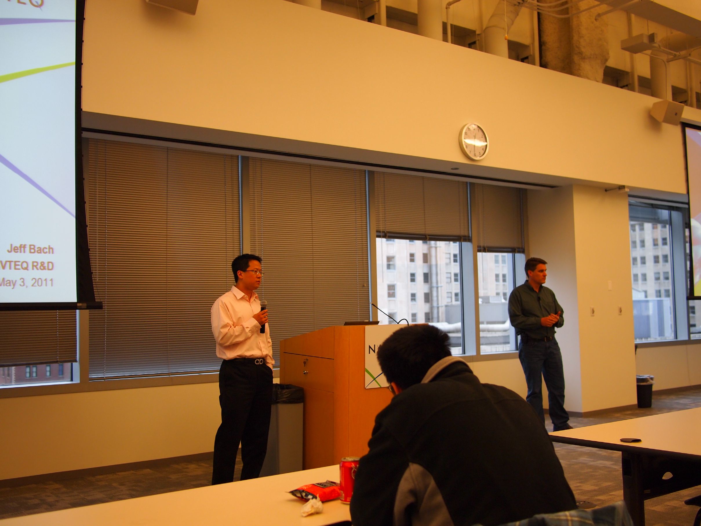
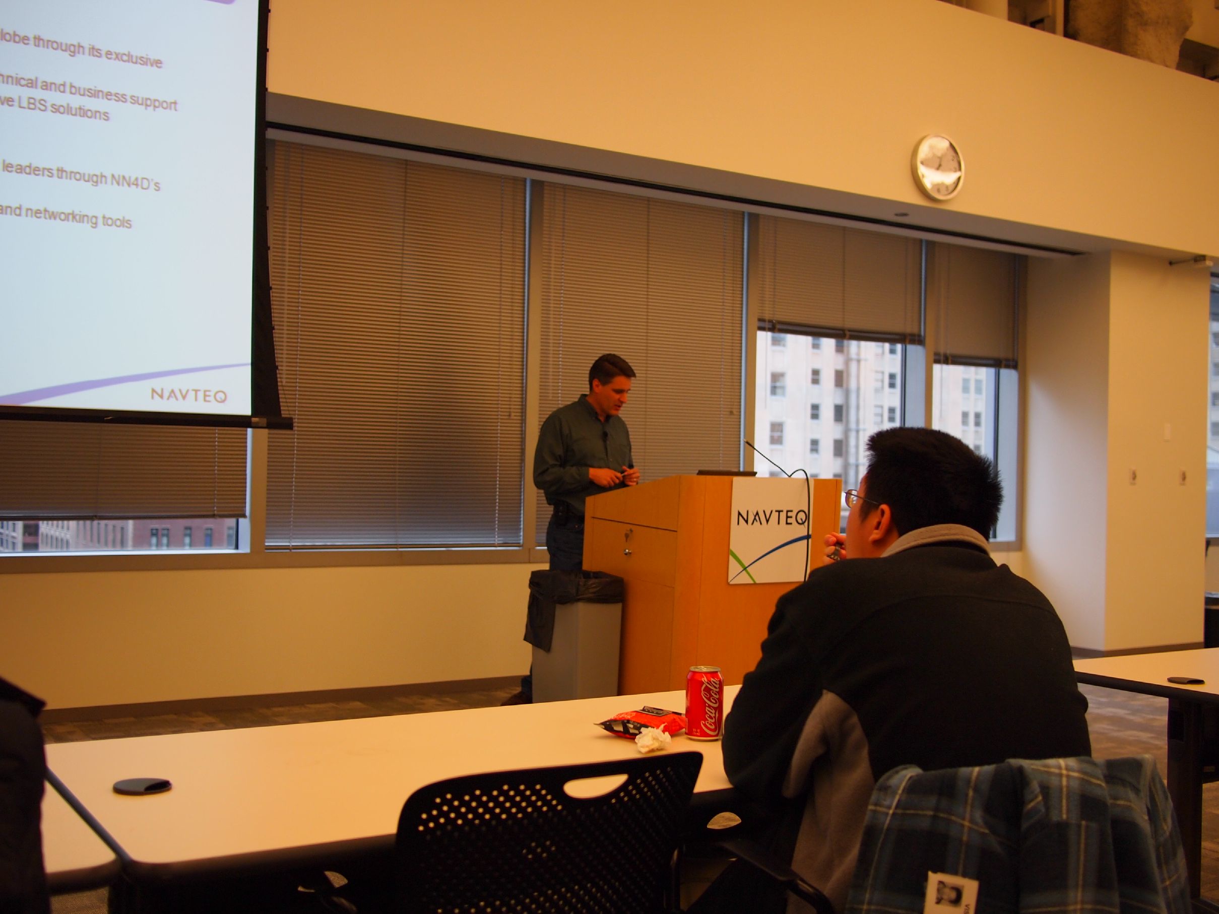
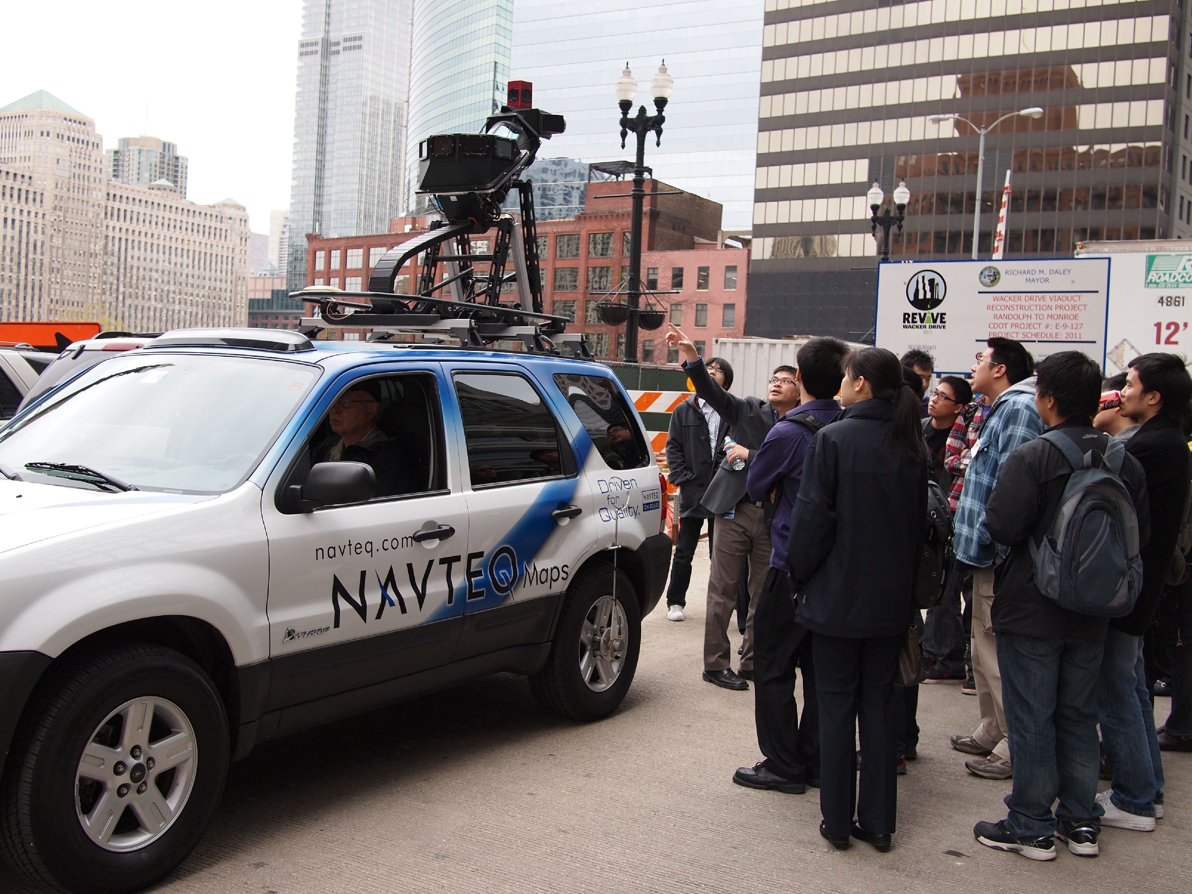
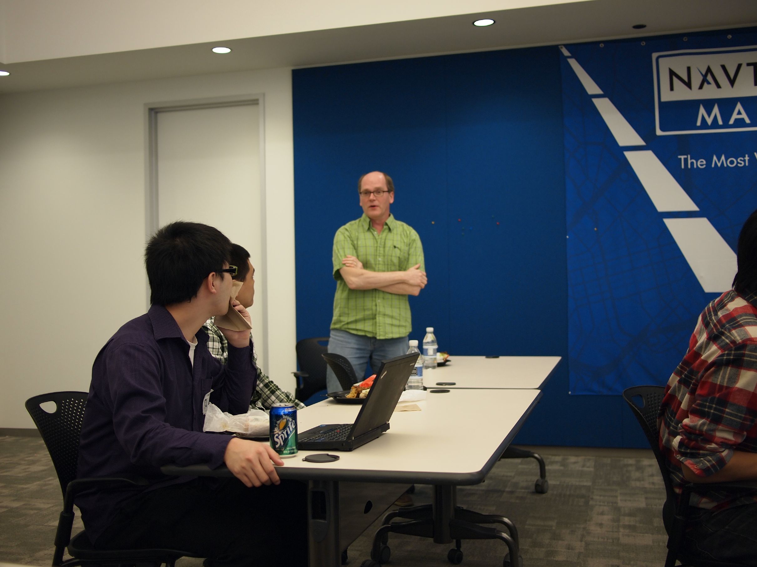
Lunch and Learn at NAVTEQ Headquarters on May 3, 2011 

Professor Xin Chen, a Senior Research Scientist at NAVTEQ, welcomes Geospatial Vision and Visualization students to NAVTEQ.

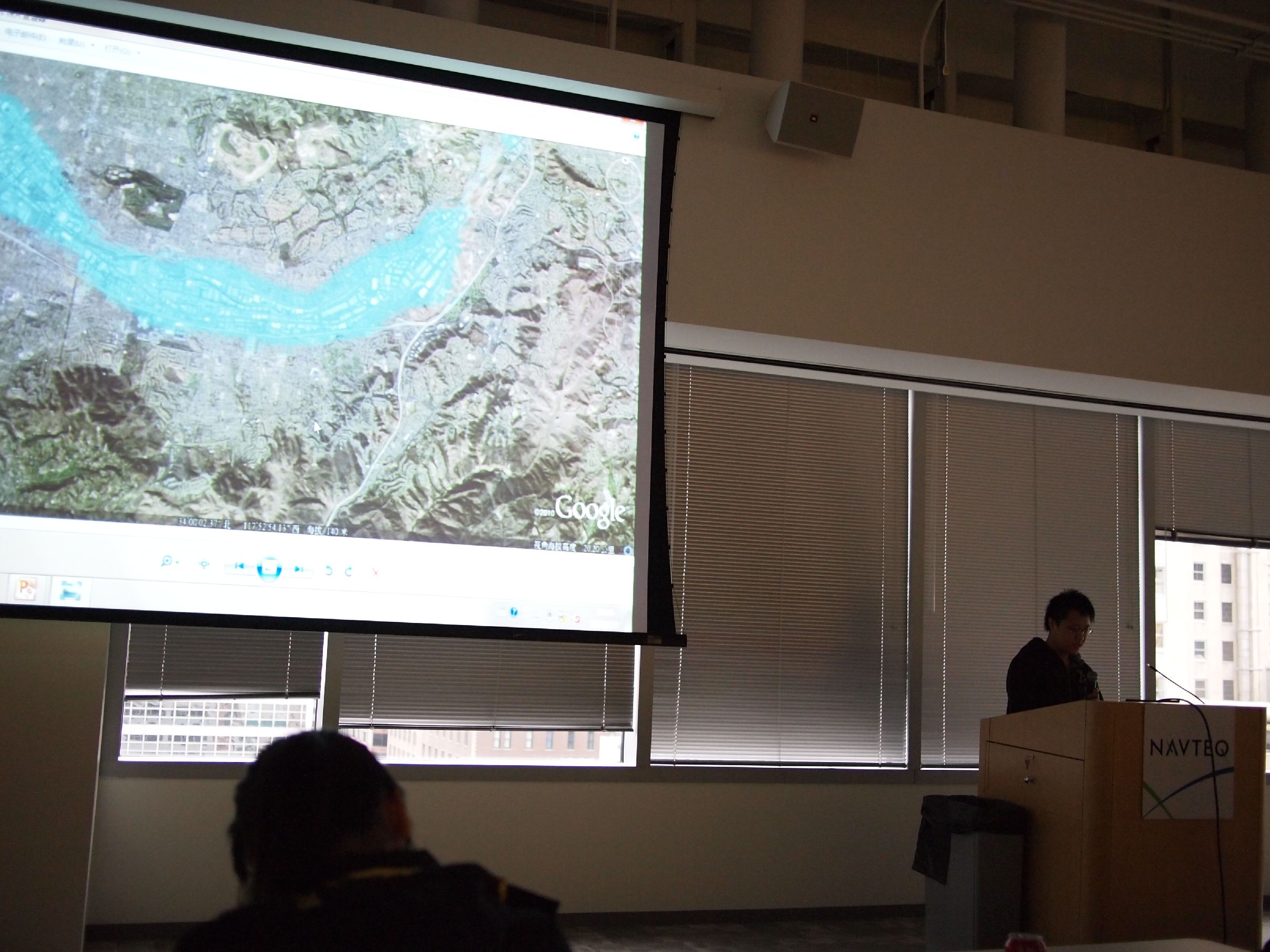
NAVTEQ Research Director Jeff Bach presents an overview of NAVTEQ technologies and research to Geospatial Vision and Visualization students.

Systems Engineering Manager Roger Hui gives Geospatial Vision and Visualization students a behind-the-scenes look at NAVTEQ True, NAVTEQ’s next generation mapping technology.

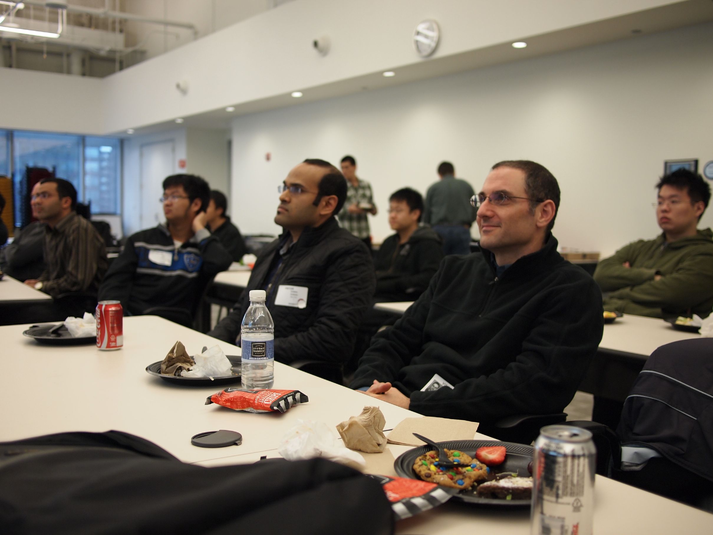
Geospatial Vision and Visualization students network with NAVTEQ R&D members.

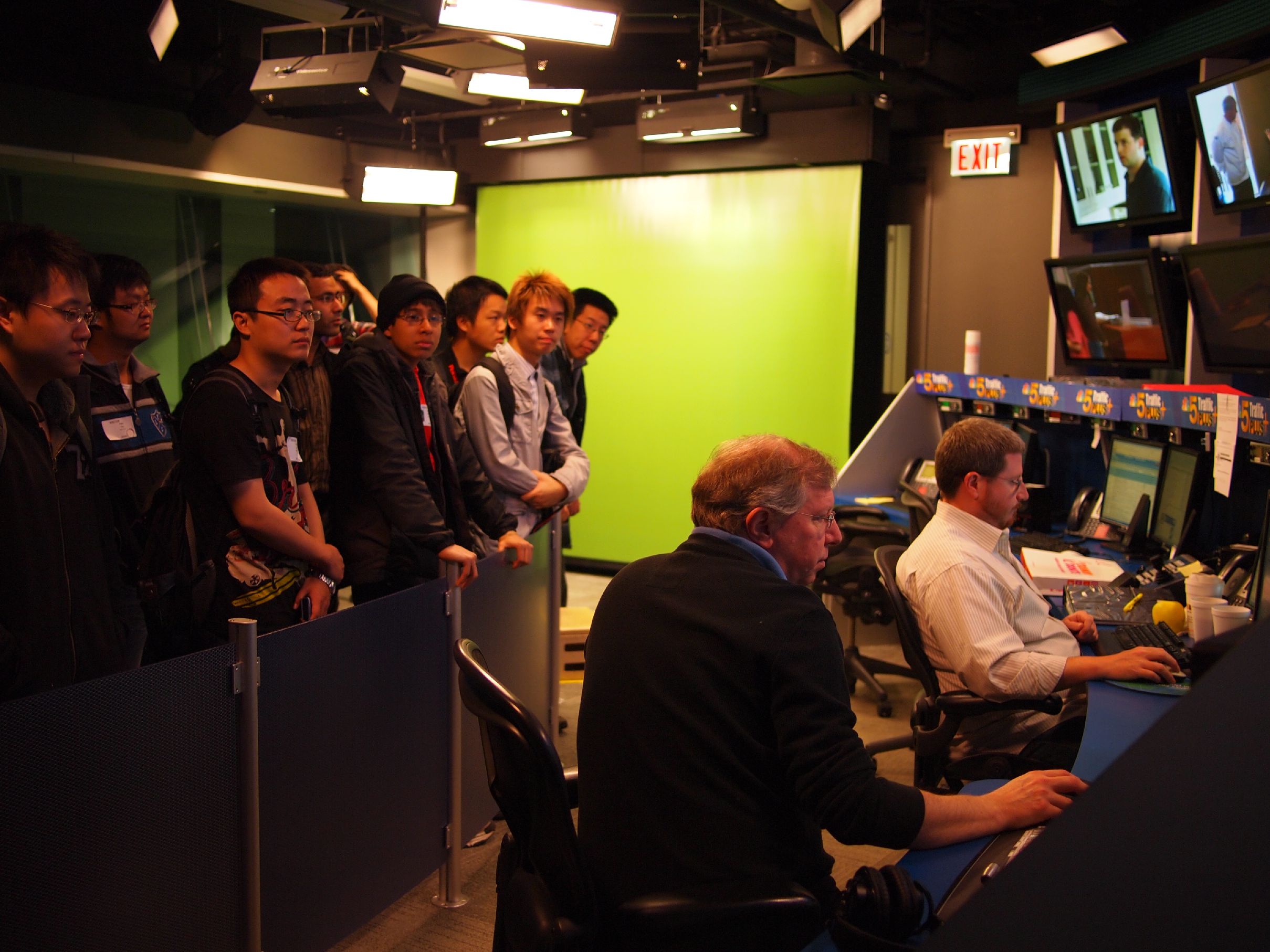
Geospatial Vision and Visualization students tour the traffic studio that houses NBC Channel five and several radio stations including National Public Radio (NPR) and local celebrity Sarah Jindra.

Geospatial Vision and Visualization students present their final course projects to R&D senior managers and staff.

Professor Gady Agam and his Virtualization students participated in this event.

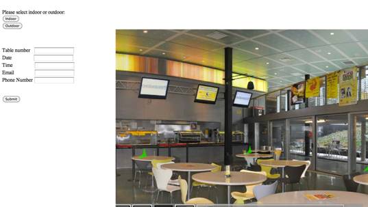
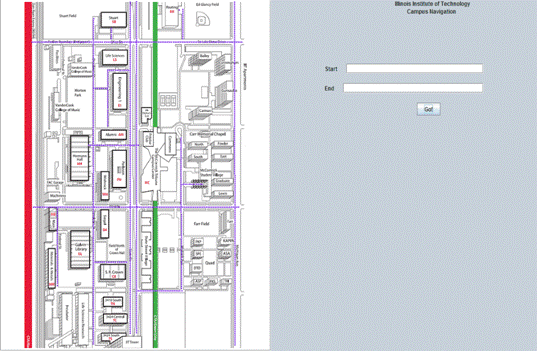
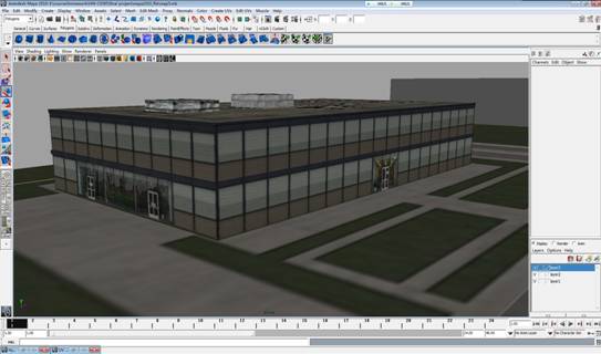
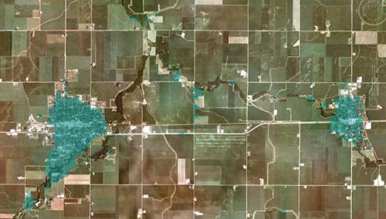
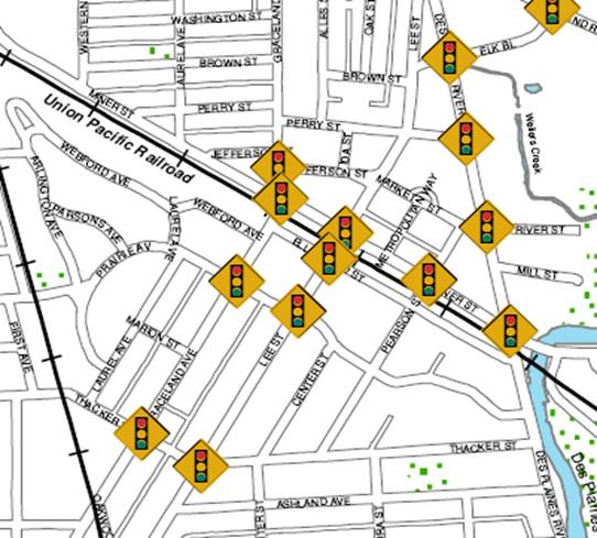
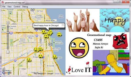
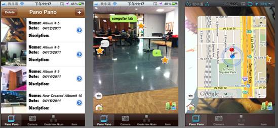
Featured Final Course Projects (Each of the 24 students was able to develop a final project within a month’s time)

A Restaurant Reservation System Powered by Panoramic Views

Li Xie

This project builds a prototype system for users to reserve specific seating at restaurants by viewing panoramic imagery of the inside.


Campus Navigation System

James Lee, Ashlie Mis and Michael Ou

This project builds an interactive map of the IIT campus where students can easily find a path from one building to another. It can display multiple paths at once. The floor plans and panoramic views inside the building can be interactively displayed using this system.


3D IIT Campus

Chang Guo, Cong Liu, DongXu Ren and Yitian Pan

This project builds 3D models of the core IIT campus using flash, photoshop and maya. The raw data is collected from the internet and digital cameras.


Satellite Image Recognition

Yu Pan

This project applies color histogram features to computer vision algorithms to extract land features from satellite imagery.


Traffic Light Recognition and Its Applications

Jorge M Penalva Zambrano

This project maps traffic lights by recognizing them from street level imagery using computer vision. An application is developed to use the traffic light map to route and avoid traffic lights for drivers.


Geo-emotional Map

Marcos Arroyo, Sujin Ri

This project tracks the collective mood of the population through social network sites and visualizes the emotions on a map.


Pano-Pano iPhone App

Changchen He

This project develops an iPhone app for users to easily create and share geo-referenced photos, tag, and augment reality.


hit tracker